Demonstration goals:
- Understand how Euler’s theorem relates to plate motions
- Know how to apply Euler rotation vectors to find linear velocities at a plate boundary
- Know how to apply Euler rotation vectors to determine boundary type
Definition: Euler’s fixed point theorem states that any motion of a rigid body on the surface of a sphere may be represented as a rotation about an appropriately chosen rotation pole, called an Euler pole. Geologists have used this theorem to understand the motions of tectonic plates. The axis about which two plates, i and j, rotate with respect to each other is called the rotation axis. It passes through the center of the Earth, and pierces the surface of the Earth at the two Euler poles; equivalently, the Euler poles are the sites on the Earth’s surface where the angular velocity vector  is located. The linear velocity vector for any point may be found from:

 is equal to
  , where
  is the angle between the rotation pole and a is the radius of the Earth. Since vectors in general are additive, the (unknown) rotation vector for any plate may be found by combining the (known) rotation vectors from two other plates:


 We will perform a more sophisticated demonstrations of plate rotations than the one using the simple Euler pole; many more can be found in Cox and Hart [1986]
To perform this demonstration in class, you will need:
- Two transparency sheets
- Overhead projector
- Scissors
- Pen suitable for marking on transparencies (Vis-a-Vis or equivalent)
- Thumbtacks
- A small rubber eraser
- Tape
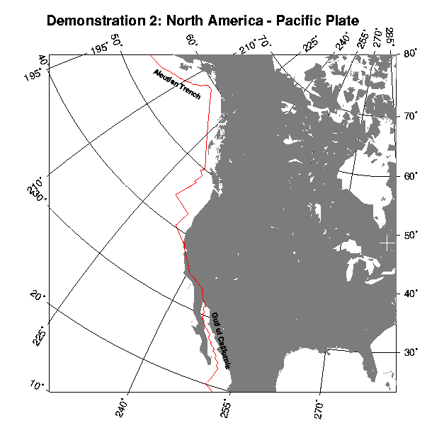
A printout of the illustration shown below.
Photocopy the illustration onto a transparency sheet. Place the North America-Pacific illustration underneath the second transparency sheet. Trace the position of two or three landmarks, and mark the rotation pole with an X, so that you can align the illustrations later. Cut the North America-Pacific illustration along the plate boundary (thick line). Place the Pacific Plate over the previously marked points on the remaining transparency sheet, and tape it into position. Push the thumbtack through the sheet from underneath, at the point corresponding to the rotation pole. Align the rotation pole marks for the transparency and the North American Plate and push the thumbtack on through. When you are done, both crosses should lie one on top of the other. Cap the thumbtack with a rubber eraser. This completes the assembly of the demonstration apparatus.
Before the demonstration:
Double check that the overhead projector in the room is working.
1. Place the North America – Pacific apparatus onto the overhead stage.
2. Slowly rotate North America counter-clockwise around the rotation pole. Note that the Gulf of California is a spreading center and that the Aleutian Trench is a subduction zone. Also note that the sense of motion along the San Andreas is correct.
3. Repeat part 2, only with the opposite sense of rotation (clockwise). This is equivalent to running time backwards; The Gulf of California may be seen to close.
(For fun, you may wish to mark the position of Los Angeles on the map, and trace it as it moves to the North.)
For Discussion:
Why does reversing the sense of rotation cause the Gulf of California to close? How do the plate motions relate to the types of earthquakes in the various regions?
