Demonstration goals:
- Understand the difference between absolute and relative plate motions
- Demonstrate how hotspots can provide an absolute reference frame for plate motions
- Understand the limitations of this method
Plumage
 Global topography illustrates the geometry describing the motion of the great plates of Earth’s lithosphere in many ways. Most obvious are features showing “relative” plate motions between neighboring plates. At the long midocean ridges, hot material upwells from the deeper mantle and cools to form plates which then diverge. Subduction takes place at deep-sea trenches, where one plate dives under another and reenters the mantle. From the fit of continents (split when new ocean basins formed), we can determine past plate motions. However, while these features tell us much about how the plates have moved with respect to each other, they reveal little of how the plates have moved with respect to the underlying mantle.
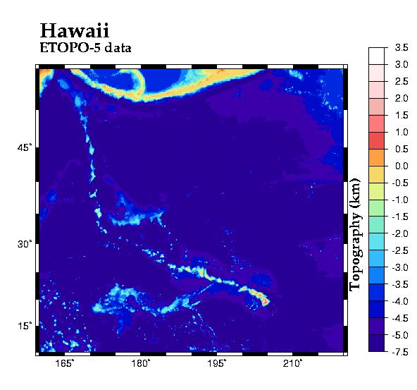
For this information, we must look to another type of feature entirely: linear chains of seamounts, such as the spectacular one extending from the Hawaiian islands northwestward across the Pacific to the Emperor Seamounts. These chains are thought to form over “hot spots”; places where plumes of hot material upwell from deep in the mantle. As a plate moves over the hot spot, new volcanic seamounts form (sometimes reaching the sea surface as islands), and are then carried away from the hot spot by the plate’s motion. If the plumes do not move with respect to the mantle, then the direction of absolute plate motion can be found from the trend of the resulting seamount chain, and the rate of motion can be found from the progression of volcanic ages.
This demonstrates that the geometry of plate motions, a classic tool of post-1960 geology, not only remains powerful but can yield new insights, using only the simplest of tools (paper, pencils, compass and a straightedge). Geology departments might emulate Plato’s Academy and inscribe over the door “let no one ignorant of geometry enter.”

To perform this demonstration in class, you will need:
- Two transparency sheets
- Colored pens suitable for writing on transparencies (e.g., Vis-a-Vis)
- Tape
- Overhead projector
- Volunteer to hold the pen
A printout of the two patterns shown below (or draw your own)
 |
 |
Photocopy (or draw with the pen) the two patterns onto the transparencies. Cut the Plate transparency along the thick line. Tape the Mantle overhead onto the projector stage. Double check that the overhead projector in the room is working.Before the demonstration:
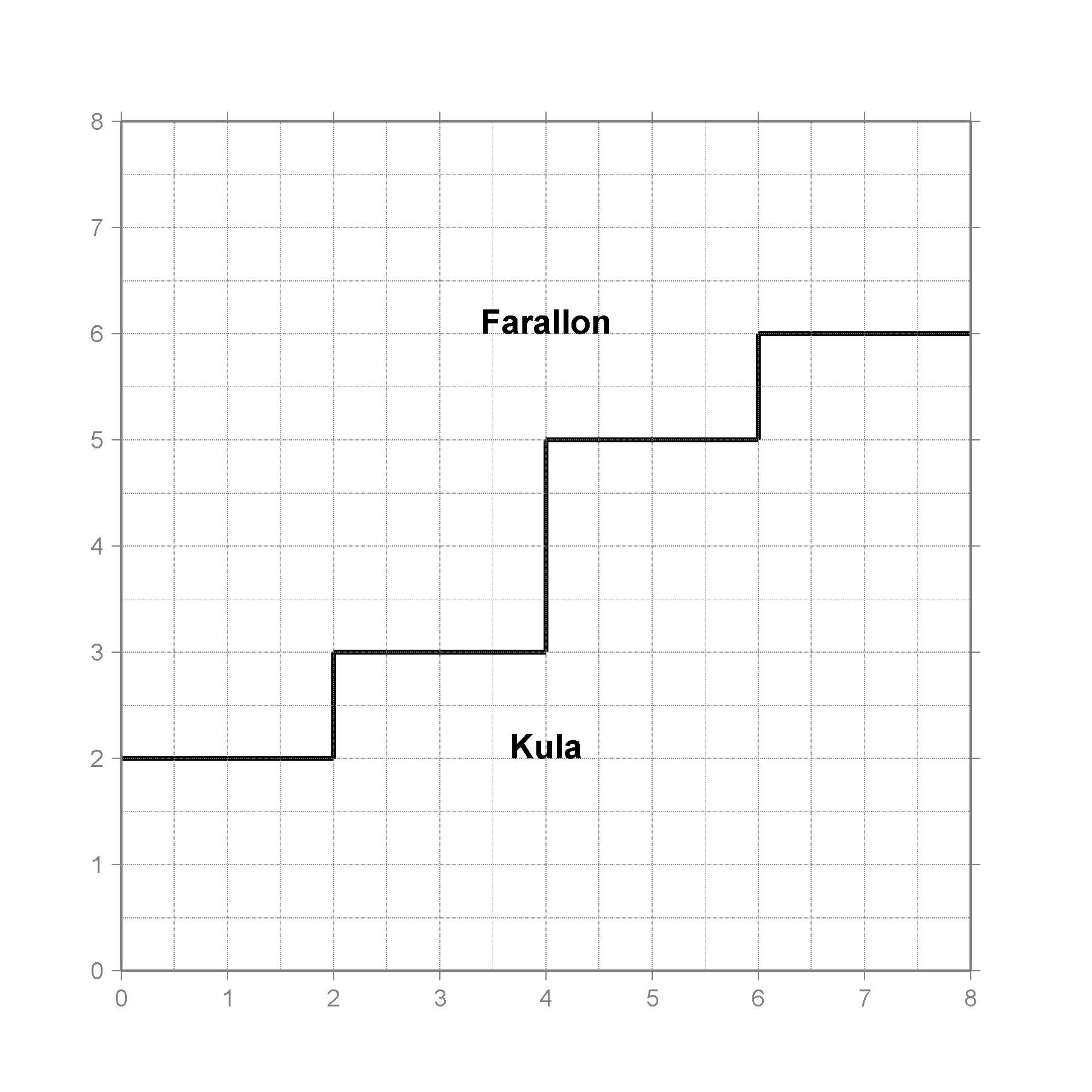
1. Place the two plate pieces on top of the mantle. Point out the features associated with each part of the plate (ridge, transform fault, etc.).
2. Show that the two plates can move in several different ways and still create the same relative positions by holding Farallon fixed and moving Kula, then repeating the motion with Kula fixed and moving Farallon. (NOTE: Especially dextrous teachers may be able to move both Farallon and Kula relative to the Mantle while spreading.)
3. Have a student hold the pen (representing a plume) fixed at one point over the mantle. Move the two plates, and show the line (representing the seamount chain forming the hot spot track) that is created by the motion. Repeat with several different positions of the pen and senses of relative motion.
Related pages:
TOPEX/Poseiden Estimated Seafloor Topography
This demonstration was adapted from Seth Stein’s article “Hotspotting in the Pacific”, which appeared in Nature, 387, 345-346, 1997