Route Maps
Route maps documented the expansion of airlines’ networks. Imaginative graphics and bold designs lent themselves to maps’ use as advertising tools when displayed in passenger timetables, as was the case with the Royal Air Maroc and Ethiopian Airways examples below. When published in annual reports, they served to inform those with business interests in the company of expansion – both of routes and of profits, and to celebrate airlines’ growth over the years.
Royal Air Maroc Route Map 1965
The route map printed in the November 1, 1965 to March 31, 1966 Royal Air Maroc timetable offered passengers a modern, abstracted diagram of the destinations where the airline traveled, connecting to points in northern Africa and western Europe.

Royal Air Maroc Timetable, 1965. George M. Foster Timetable Collection, Transportation Library
Ethiopian Airlines Route Maps 1961 - 1969
The expansion of the Ethiopian Airlines network within Ethiopia and beyond during the 1960s is illustrated in maps drawn from the airline’s passenger timetables for 1961, 1965, and 1969. By the end of the decade, the airline offered flights to a network that stretched from the airline’s headquarters in Addis Ababa to Delhi, Madrid, Dar es Salaam, Accra, and points in between, as well as covering an extensive network within Ethiopia.

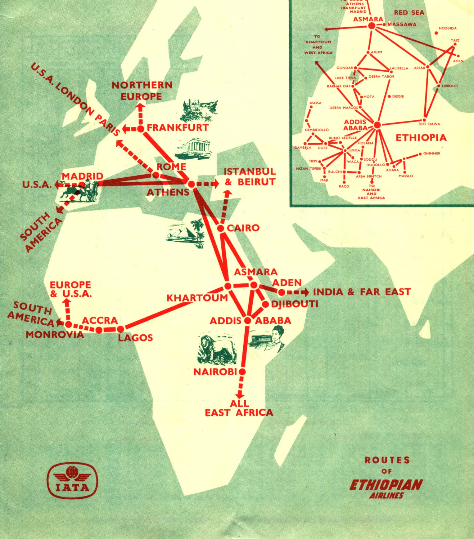
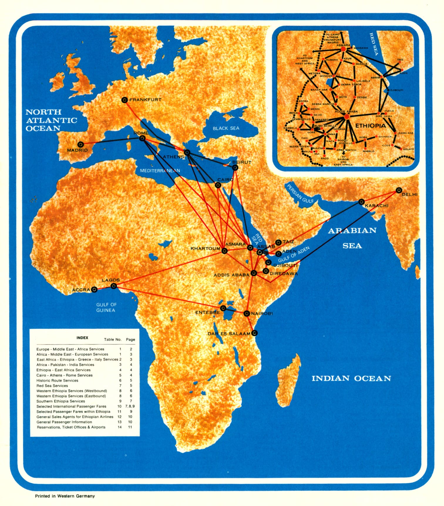
Ethiopian Airlines 1961, 1965, and 1969 Timetables. George M. Foster Timetable Collection, Transportation Library
Sudan Airways Route Map 1961
Formed in 1946, Sudan Airways was among the earliest national airlines founded in Africa. The airline’s 1961 route map, published in its passenger timetable for that year, illustrates the growth of a network that began fifteen years earlier serving Sudan and Eritrea, and which grew into a network stretching far beyond its base in Khartoum.
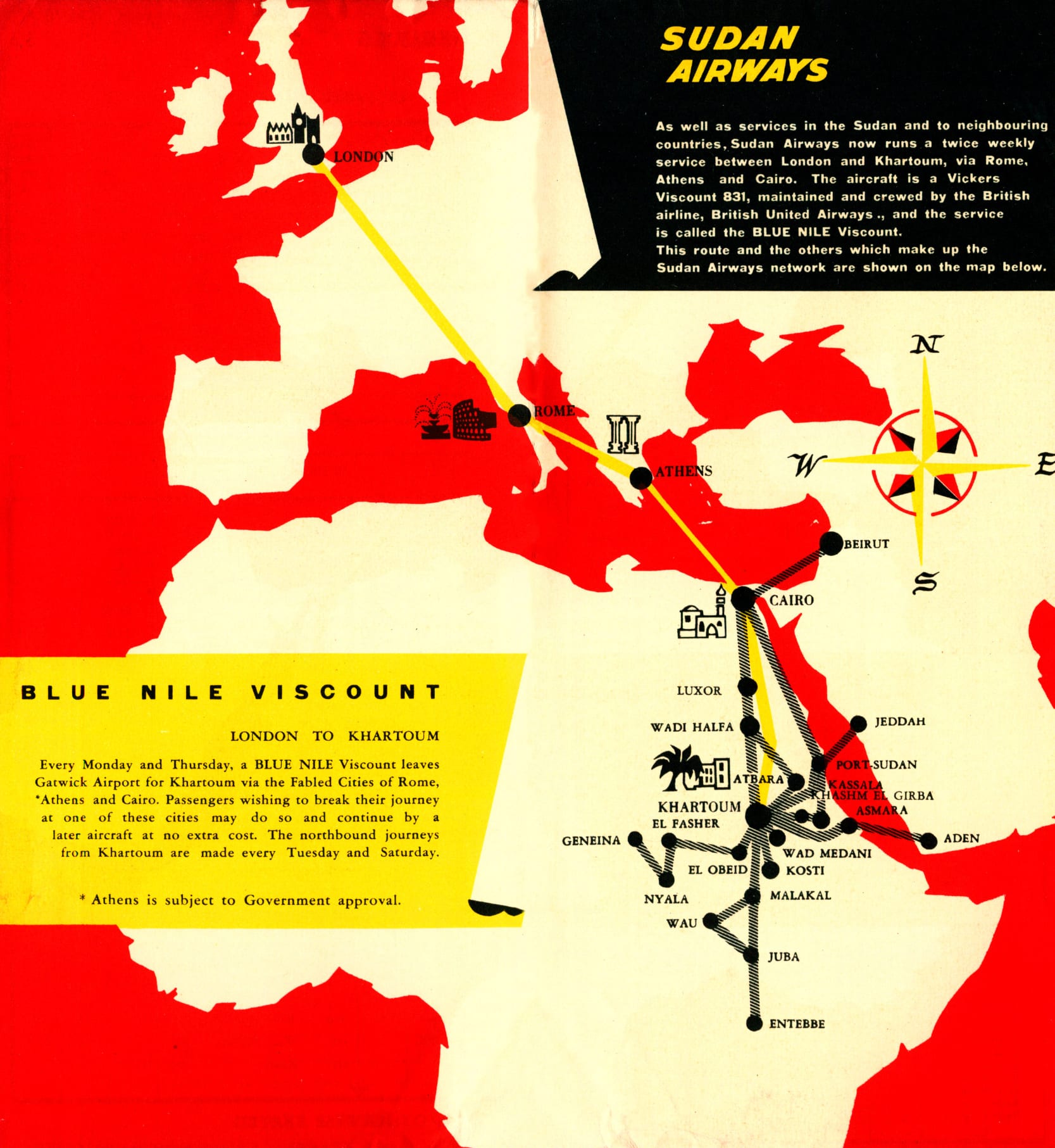
Sudan Airways Timetable, 1961. George M. Foster Timetable Collection, Transportation Library
Tunis Air Route Map, 1965
The Tunis Air timetable from 1965 included a system map, illustrating landmarks for the traveler in various destinations. Also provided was information on the airline’s routes to destinations including France, Belgium, Libya, and Lebanon, served by a fleet that included two Douglas DC-4s, one DC-3, and two Caravelles. This represented considerable growth from the airline’s initial operations, focused primarily on routes connecting Tunisia and France which, in the very earliest years, were operated using four Dakota DC-3 planes purchased from U.S. Army.
.
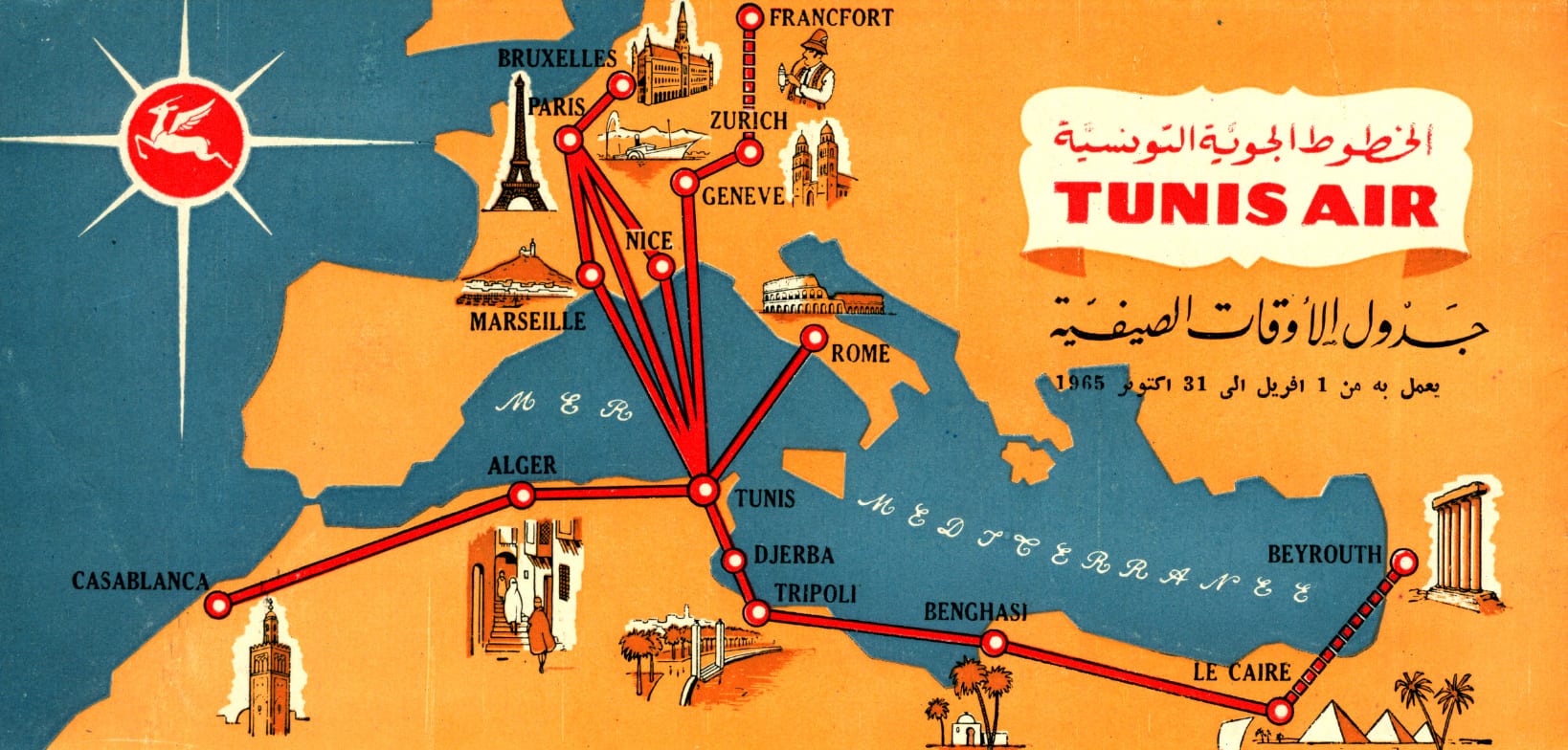
Tunis Air Timetable, 1965. George M. Foster Timetable Collection, Transportation Library
Air Malawi Route Maps 1969 - 1972
Route maps from annual reports, such as these from Air Malawi dating from 1969, 1971, and 1972, were situated within larger accounts documenting financial, engineering, traffic, and operations activity from the previous year. This makes it possible to see the airline’s route maps in the context of its growth: from 38,513 passengers carried in 1969, it expanded to 134,712 by 1972, with an increase in passenger miles flown from 12,714,864 to 71,053,407. However, spending – particularly on training and equipment – increased significantly during this period as well, resulting in the airline’s first net loss to date.
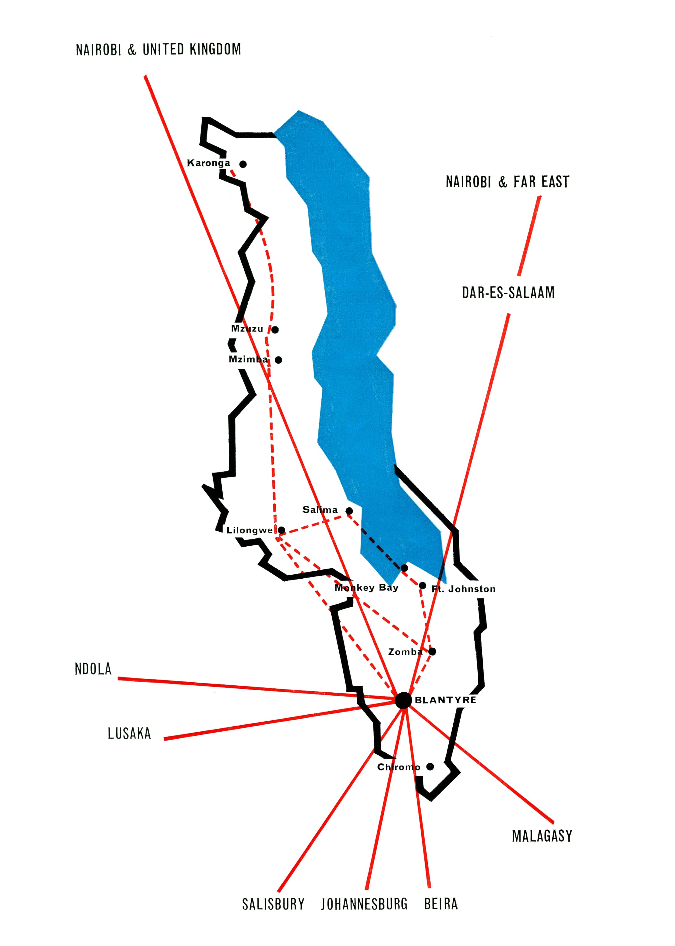

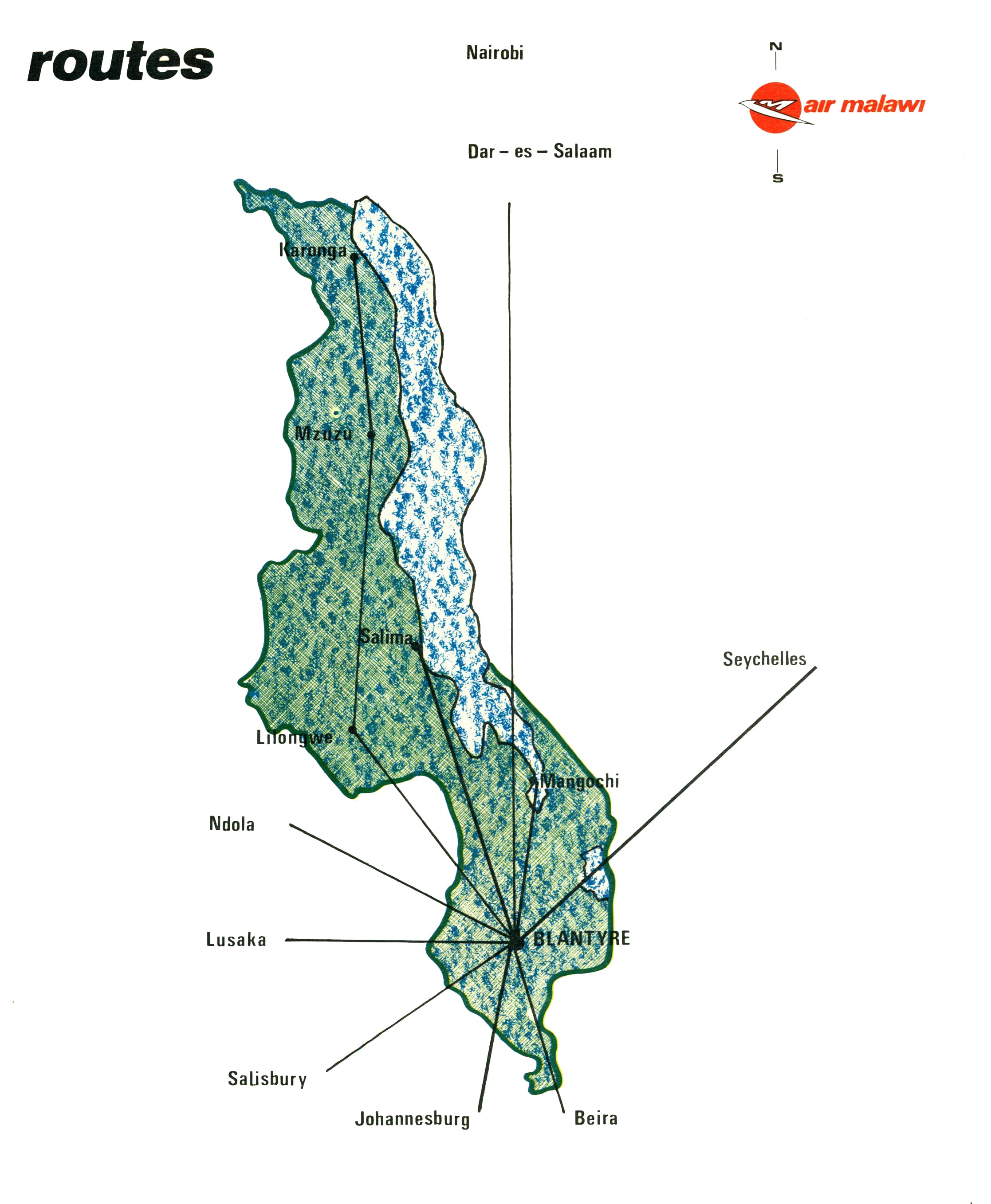
Air Malawi 1969, 1971, and 1972 annual reports
More Information
Items in the exhibit are housed at Northwestern University’s Transportation Library and the Herskovits Library of African Studies. Email transportationlibrary@northwestern.edu or africana@northwestern.edu with questions, or to schedule an appointment.